by Tom Martin, PLA, and Caeley Hynes, AICP
My colleague, Caeley Hynes, AICP, and I recently finished a research project related to alleyways in Chicago, where we explored the potential of adapting them to better serve alternative modes of transportation. While this post summarizes key findings and provides a sampling of our research, the full report can be found here.
Through Lines: An Exploration of Connections Via Chicago’s Alleyways
Alleyways are misunderstood. Upon hearing the term, most people are quick to think dirty, dangerous, or dark. While all of these reactions are valid, they undersell the magnificence of alleyways.
Defined as “a narrow passage behind or between buildings,” the designation of an ‘alleyway’ can be ambiguous. For our purposes, we will define an alleyway as a narrow passage bisecting a city block, typically accommodating back of house functions like trash collection, utility routing, and delivery services.
At one point in time, the idea of housing utilities at the back of the house was radical. In Chicago, public sentiment regarding alleyways eventually shifted to a sense of pride. Serving as neighborhood capillaries, they provide physical and social connections for Chicagoans. Simply, alleyways arm Chicagoans with the single, incontestable claim over other large cities: the clean, garbage-free street.
This research topic explores the concept of repurposing alleyway systems as an alternative framework of non-motorized connections, using the City of Chicago as a case study.
Chicago has a sizable disparity in access to non-motorized infrastructure, programming, and recreational facilities, correlating with socioeconomic backgrounds of Chicago’s communities. Alleyways are an unexplored opportunity to close the gap in access, while promoting non-motorized modes of transportation, and increasing green infrastructure within the existing urban fabric.
This research will employ various methods such as interviews, GIS analysis, surveying, immersive experience, and precedent study to understand how alleyways can be adapted.
While research is proposed to analyze existing conditions in the City of Chicago, the methodology will provide research frameworks, engagement mechanisms, and distinctive design interventions for comparable cities. This analysis aims to identify alleyway reconfiguration criteria based on a set of demographic, destination-based, and site-level factors to ensure processes and recommendations can be replicated elsewhere.
A History of Chicago’s Alleyways
Chicago has the most extensive alleyway network in the country, totaling more than 1,900 miles. While alleyways can occur spontaneously, the City of Chicago intentionally planned for alleyways from the beginning. The original town plat of 1830 included eighteen-foot-wide alleyways inscribed into “all 58 blocks.” With the national land survey grid informing Chicago’s block structure, the alleyways of Chicago became continuous, predictable, dependable places for trash collection, utility, commerce, and access. Still today, over 90% of the blocks in Chicago contain alleyways. By providing alleyways within the center of blocks and limiting trash from primary pedestrian thoroughfares, the City of Chicago had managed to limit the spread of rodent borne diseases that plagued other cities like NYC.
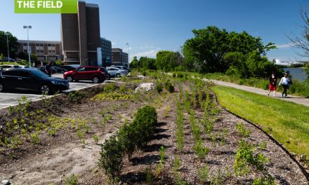
In the last several years, the appreciation of alleyways in the City of Chicago has re-emerged, even manifesting into a 2001 City-wide Green Alley initiative to improve and better utilize this essential resource. To this day, more than 300 Green Alleys have been installed throughout the City.
Chicago is known as the alleyway capital of the country, for good reason. Chicago’s initial and continued investment in its alleyways has served as an invaluable precedent for other cities and has paid dividends to every citizen of Chicago’s health and quality of life.
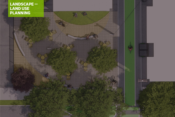
Inventory + Analysis
Geospatial data analysis is utilized in order to understand the potential of Chicago’s existing alleyway network, demographic trends in neighborhoods, and gaps in access. It should be noted that this analysis is rooted in assumptions and quantitative data.
The analysis framework is as follows:
- Existing Infrastructure. Assess where “connected” alleyways exist that run for longer than one mile.
- Understanding Access. Understand demographics and access to existing infrastructure within Chicago neighborhoods.
- Connecting Resources. Identify alleyways longer than 1 mi that directly connect to community resources.
- The Big Picture. Identify neighborhoods experiencing gaps in access with alleyway segments that are continuous for longer than one mile.
Existing Infrastructure
This analysis identifies “connected alleyways” that are naturally occurring in the City today. For the purposes of this analysis, “connected alleyways” are designated as a series of connected routes with entry/exit points within 200 feet of each other. These naturally-occurring alleyways are ripe for retrofit and non-motorized uses.

Understanding Access
A weighted analysis was used to measure the severity of the following demographic and infrastructure conditions within Chicago neighborhoods today:
Social Vulnerability
- Vehicular ownership
- Poverty levels
- Education
- Race + ethnicity
- Disability status
- Exposure to pollutants
- Population density
- Housing unit density
- Walkability
Infrastructure + Access
- Areas more than 0.5 miles away from a neighborhood greenway or protected bike lane
- Areas more than 0.25 miles away from an off-street trail
- Amount of accessible parkland per 1,000 people
- Areas within a 0.25 mile radius of incomplete or missing sidewalk conditions

Connecting Resources
Alleyways running longer than one mile are overlaid in order to identify which alleyways directly connected to the highest number of community destinations. For the purpose of this research, “community destinations” are as follows:
- Public/private schools
- Chicago libraries
- Daycares
- Total jobs
- Bus/transit stops
- CTA rail stations
- Metra stations
- Bus stops
- Divvy stations
- Retail
- Restaurants
- Rec, nature, cultural facilities
- Museums
- Places of worship
- Health center
- Urgent care centers
- Hospitals
- Chicago service centers
- Grocery
- Farmer’s markets
- Community gardens

The Big Picture
Building upon previous steps, the final composite map displays “connected” alleyways
with high frequencies of direct connections to community destinations in areas of social vulnerability. According to these factors, the following community areas have been identified for further research:

Baseline Retrofits

Focus: West Ridge
Located on the North Side of Chicago, West Ridge is a thriving and diverse mix of cultures, with a significant amount of culinary and open space destinations. Today, the community lacks non-motorized connections to route residents to destinations, specifically along Devon Avenue – a key node for Chicago’s Indian, Pakistani, and Jewish communities. The alleyway of study within West Ridge is directly north of Devon Avenue.


West Ridge Intervention Opportunity
Problem
A primary concern of introducing new non-motorized passages within alleyways is establishing crossings where no infrastructure currently exists. This creates conflict points between motorists and non-motorists.


Methodology
While the purpose of this research was context-specific to Chicago’s alleyway system, the research methodology could serve as a framework for similarly designed cities.

Conclusion
The problems of this generation demand innovative policy and creative design, warranting a restructuring of the established models. While affordability, equity, and sustainability issues are complex and globally experienced, solutions lie at the neighborhood and site-specific level. The public realm should be designed for the community, prioritized by governing bodies, and preserved by users in order to create long-lasting social, economic, and environmental benefit within the American fabric.
Comprehensive solutions exist within our current infrastructure—and we need to be audacious enough to seek them. Our cities can be more if we can discover the through line.
If you have any questions about Through Lines: An Exploration of Connections Via Chicago’s Alleyways, please contact [email protected].
Tom Martin, PLA, is a landscape architect in SmithGroup’s Chicago office. He has long been curious about the potential of alleyways and other dormant infrastructures and their greater potential. Tom is a past co-chair of ASLA’s Environmental Justice Professional Practice Network (PPN).


