by Taner R. Özdil, Ph.D., ASLA, Kal Almo, ASLA, AIA, Lauren Patterson, PLA, ASLA, Jenny Zhang, Associate ASLA, Tyler Smithson, ASLA, and Brent Raymond, ASLA, OALA, FCSLA, MCIP RPP
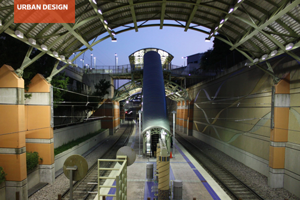
Transit Oriented Districts have been helping reinvigorate towns and cities across the United States and Canada. Beyond the limiting definition of Transit Oriented Development (TOD), Transit Oriented Districts (TODts), are typically defined as the whole area within half a mile of a transit station and are seen as desirable choices for development in metropolitan areas to accommodate the concerns surrounding population growth.
TODts are typically characterized by higher development density and a varied mix of land uses, offering sustainable development options to counteract some of the negative effects of urban sprawl, declining urban cores, and congestion sparked by rising populations and mobility. They contain a diverse mix of uses such as housing, employment, institutions, shops, restaurants, and entertainment. These districts aspire to have a strong sense of place, and a diverse set of travel mode choices. TODts are typically designed in conformance with a coherent district plan or zoning overlay that commonly stipulates the type and scale of uses, permitted densities, and related regulatory and recommended items. These districts are usually expected to be organized around the station areas with unified plazas, squares, parks, and streetscapes, and function more like a district than a single development and a project (Ozdil, 2014).
By refocusing design, planning, and transportation practices from cars to other modes of transit, more space can be dedicated to other human purposes, experiences, and city needs. A typical Transit Oriented District favors:
- Focused development (often based on a comfortable walking distance) over sprawl
- A coherent district plan (with a balanced distribution of green and open spaces and streetscapes) rather than a single project
- Pedestrian, cyclists, and mass transit access over the automobile
- Higher density developments, over single story developments
- Compact and shared parking (parking garages and street-edge parking) instead of surface parking lots
- Mixed-used development over conventional zoning and development
The scaffold of the TODt has been adapted to different area types with a diverse set of goals. There may be different factors that lead to variations in their implementation. Population density, available transit options, and the existing infrastructure are consistent factors. Climate, COVID-19, and other concerns, often tied to specific metropolitan areas, also influence how TODts are realized. Thus, it becomes essential to work with typologies that respond to varying densities and needs across a given metropolitan area or urban region. Examples of typologies are Urban Downtown, Urban Neighborhood, Suburban Town Center, Suburban Neighborhood, Neighborhood Transition Zone, and Commuter Town Center (Dittmar et. al., 2004). Additionally, as more of these districts arise, bodies of research and lessons learned influence the next generation of Transit Oriented Districts.
This article is written as a follow-up to the Urban Design Professional Practice Network (PPN)‘s collaborative panel with the Transportation PPN on Transit Oriented Development, which was presented as a webinar in February 2024. The article discusses and reinforces the relevance of a Transit Oriented Districts and offers lessons for pedestrian experience and placemaking to better inform the planning, design, and implementation processes. To get a snapshot of how different cities are implementing them, Urban Design PPN members from different urban regions looked at recent station areas’ TODs or TODts in their communities. They explain their local and regional insights and their experiences.
TOD & TODt Cases & Experiences
TOD: Observations from the Port Authority Trans-Hudson (PATH) in NJ/NY
Mode: Rapid Rail System from Jersey City to Midtown Manhattan
Typology: Urban Downtown, Urban Neighborhood
Author: Jenny Zhang, Associate ASLA, AICP Candidate, with WSP USA
The New Jersey and New York area undeniably have significant opportunities for Transit Oriented Development (TOD) projects. I was most attracted to those smaller-scale interventions that contribute to the placemaking of the downtown centers and urban neighborhoods along the transit lines. As a daily public transit user who commutes from Jersey City in New Jersey to Midtown Manhattan, I am fortunate to witness several placemaking projects along my commute on PATH.
My commute journey starts with Newark Avenue in Jersey City, a 0.2-mile pedestrian mall connecting to the Grove St PATH station. This street underwent a conversion into a pedestrian mall a few years ago, and the planters, benches, safety bollards, and string lights significantly enhanced the pedestrian experience. On sunny days, the colorful umbrellas, tables, and chairs from the restaurants along Newark Ave make the street more vibrant.
The density and scale of the built environment change significantly when I arrive at the 33rd St PATH station in Midtown Manhattan. The scale of four-story buildings on the Newark Ave pedestrian mall suddenly increases to skyscrapers. Herald Square Plaza, at the intersection of 34th Street, 6th Ave, and Broadway, is a small urban park with movable tables and chairs, and filled with beautiful landscaping, providing a buffer from busy traffic. Its convenient location near multiple MTA subway lines, bus routes, and the PATH station makes it a popular spot for people to stop by and take a break. The lush green landscape in the foreground and the beautiful architecture, with the Empire State Building in the background, calmed me down from the hustle and bustle of city life.
Newark Avenue and Herald Square have taken the approach to create a strong sense of place and enhance the pedestrian and commuters’ experiences in urban neighborhoods. Though they vary in scale and type, both contribute to the vitality of street life.
TOD: Observations in 2024 from the LYNX Blue Line in Charlotte, NC
Mode: Light Rail – Charlotte Area Transit System (CATS)
Typology: Urban Downtown, Urban Neighborhood, Suburban Neighborhood
Author: Lauren Patterson, PLA, ASLA, with VHB
Charlotte, North Carolina, has a population of almost 900,000 people and is a car-oriented city with 76.6% of the population driving alone to work. It currently is serviced by one commuter rail that runs north-south through the city and is packed during weekday commuting hours. The Blue Line first opened in 2007 and contains all primary amenities for a transportation stop. The experience throughout the corridor, however, varies at different segments throughout the route. There are three primary district types along the corridor: the urban Central Business District, the urban neighborhood, and the suburban neighborhood.
The core of the Blue Line is in the Central Business District and is connected to major amenities of Charlotte such as: the convention center, offices, museums, and stadiums. The transit stops in this area are interconnected to the urban fabric with high-density, mixed-use amenities at every stop.
Examples of the urban neighborhood districts along the Blue Line are SouthEnd and NoDa. South End is a district that has seen an explosion of growth due to transit infrastructure. What used to be a light industrial warehouse district is now a thriving innovative community. Buildings are oriented towards stations, there is safe access to each stop, and mixed-use densities throughout the whole district. What sets this environment apart is the rail trail, art, and residential communities. Increased residential densities adjacent to the rail trail create a very active environment and the art installations define the character of SouthEnd.
The remaining stops around the Blue Line are more suburban in nature. Dated commercial complexes, big box retail, disconnected single family neighborhoods, and strip centers characterize the development near each station. There are few sidewalks, bike lanes, or bus routes that will connect the train to the neighborhood they serve.
TOD: Mockingbird Station, Transit Oriented Development, and District, Dallas, TX
Mode: Light Rail and Bus Transit, Dallas Area Rapid Transit (DART)
Typology: Urban Neighborhood/Suburban Center
Author: Taner R. Ozdil, Ph.D, ASLA, with The University of Texas at Arlington
Mockingbird Station is considered as the first TOD in the Dallas-Fort Worth metropolitan region, designed around a multi-modal Dallas Area Rapid Transit (DART) hub in 2001. Initially, this was a 10-acre infill development in an urban neighborhood that used adaptive reuse strategies for the former Western Electric Building and transformed the station area into a commercial, residential, and entertainment complex with a movie theater, restaurants, and boutiques. When the passenger climbs from the station tunnel to the ground level, s/he is welcomed with a development connected to the existing station by a bridge that crosses the rail line.
The development acts as a neighborhood/suburban center while offering a bus station, park-and-ride facilities, and structural and at-grade parking, which also serves nearby offices, commercial, and multi-family buildings in adjacent lots. Due to population growth and higher demand for the overall district that houses a private university, presidential library, and major office towers within walking distance, the pedestrian network is enhanced further by improved sidewalks, enhanced design for night uses, and added pedestrian bridges to connect nearby blocks, and a regional trail system.
Mockingbird TOD has been significant, if not catalytic, in experience and placemaking because the original project attempted to realize the potential of this light rail station through a uniform development plan for its station area while challenging deeply rooted automobile-friendly culture with multi-modal and mix-use strategies in North Texas. By today’s standards, the development and district still attempt to do all this with medium density and somewhat distinct but segregated uses in a confined area.
Experience of the Mockingbird TOD also made one realize that there is more to be done. The district has opportunities for a stronger pedestrian sidewalks and core, pedestrian-friendly density, and most importantly compact land uses and urban morphology that would cater to 21st century city dwellers in this particular context. The district also calls for adding a variety of affordable living options and revamping its retail, entertainment, and parking options. Most importantly, the TOD must be empowered further as a critical hub for the region by seamlessly connecting the original development with the broader transit-oriented district.
TOD: Transit Oriented Communities in Salt Lake City, UT
Mode: TRAX, BRT, and Commuter Rail of the Utah Transit Authority
Typology: Urban Neighborhood, Suburban Neighborhood, Commuter Town Center
Author: Tyler Smithson, PLA, ASLA, freelancer previously with Architectural Nexus
It’s a crisp April morning as I grab a coffee from my favorite cafe around the corner before hopping on the light rail headed downtown. No battling rush hour traffic, no scrambling for parking—just a quick and convenient ride to work. This isn’t just a dream; it’s a reality for many people living along the Wasatch Front because of the incredible network of the Utah Transit Authority (UTA). With 50 stations on three TRAX lines, numerous BRT stations, and a regional train called the Frontrunner, the UTA connects communities in Weber, Davis, Salt Lake, and Utah Counties.
But it’s not just about getting from point A to B. The future of our growing city lies in Transit Oriented Communities (TOCs) built around these stations. Imagine neighborhoods where everything you need is a 10-minute walk away—shops, restaurants, parks, and more importantly, easy access to public transportation. This is the vision behind the plans to consider transit oriented infrastructure near every TRAX station. However, there is a hurdle to achieving this idyllic vision. Currently, many UTA stations are surrounded by vast parking lots and auto-centric land uses that discourage walkability and create a disconnect between the station and the surrounding community.
Here is the vision: transforming these parking lots into vibrant mixed-use developments with housing, shops, and green spaces is crucial for realizing the full potential of TOCs. This would enhance convenience and foster a stronger sense of community around the station.
These walkable communities wouldn’t just be convenient; they would be good for the environment, too. Less traffic means cleaner air and a healthier planet. Plus, with more people living near stations, TRAX and the entire UTA network become even more efficient, reducing congestion and creating a win-win for everyone. TOCs are designed to be inclusive. By creating a mix of housing options near stations, we can ensure affordability doesn’t become a barrier.
Think about it: vibrant neighborhoods where everything is at your doorstep. This isn’t just about faster commutes; it’s about creating a more connected, sustainable future for all of us. With a focus on TOCs, the UTA’s network could be the key to unlocking a brighter, more livable Wasatch Front. And the best part? This future is just a TRAX stop away.
TOD: Transit Oriented Communities in the Greater Toronto Area, Canada
Typology: Urban Downtown
Mode: Subway, BRT, Regional Transit Hub
Author: Brent Raymond, ASLA, FCSLA, MCIP RPP, with DTAH
I am fortunate to work as a landscape architect and urban designer in one of the most dynamic places on the continent. It is difficult to describe to friends from other cities just how intense and sustained growth has been here in Toronto.
In the early 21st century, the Province of Ontario led an ambitious and award-winning regional planning process called “A Place to Grow: A Growth Plan for the Greater Golden Horseshoe.” In a nutshell, this plan established an urban structure that identified where growth and intensification should take place. Many of the growth areas are related to existing transit, where others are situated along future planned transit infrastructure. Urban Growth Centres are mixed-use places that will achieve the highest intensity of people and jobs, with a substantial amount of employment related to the highest order of transit. Major Transit Station Areas (MTSAs) are smaller in scale and planned for each station along LRT and BRT lines. In total, there are 25 Urban Growth Centres and 333 MTSAs defined in A Place to Grow.
The most recent program is called Transit-Oriented Communities (TOCs). TOCs emphasize that growth is not just about density yields; each community must first respond to its context and site-specific objectives, and include affordable housing, community services and facilities, and other amenities, such as parks and open spaces, to serve new and existing residents. They must deliver on sustainability and resilience targets and recognize the unique role of Indigenous peoples in shaping the region’s growth and development.
Overall, we are making progress but most of the execution is still to come. A plan of this magnitude is multi-generational in scope. I’m confident that everyone’s efforts will lead to a successful region that transforms from a post-war auto-dominated place to one that is transit-, people-, and nature-first.
TOD: The Yards, Washington, DC Navy Yards
Mode: Commuter Rail (Metro Rail Orange/Silver and Green Lines – WMATA)
Typology: Urban Downtown
Author: Kal Almo, ASLA, AIA, with AECOM
The Yards is a development in Washington, DC’s Navy Yards, a Transit Oriented District located along the Anacostia River. South Capitol Street forms the border to the west, the Dwight D Eisenhower Freeway to the north, and the Anacostia River to the south and east.
I usually take the Metro to get here; the east-west running Orange/Silver Lines that run out of Arlington easily connect to the north-south running Green Line, allowing me to avoid the expense and confusion of parking in DC. I leave Metro at the First St SE exit; my destination today is Yards Park and the Anacostia Waterfront. I could take a bike or a scooter to get around (there are a few of them) but I’m not in a rush and I want to take in my surroundings; walking is fine.
I cut over to an allée along New Jersey Avenue that leads to Tingey Plaza, a neighborhood-scaled park with integral seating formed by intersecting rectilinear concrete, steel, and wood planes. The allée also parallels one of the more prominent inland BMPs, an 8’ deep swale planted with trees, shrubs, and tall grasses, an aesthetic counterpoint to the grid of plantings along the street edge. I turn down Quander Street, appreciating the swale/copse, then take a left down Yards Place, where designers have placed the sidewalk at road level, used cobble paving, and narrowed the distance between buildings, effectively creating a woonerf. Other area streets seem scaled to the crowd; N Street and Tingey Street can feel almost empty without the frequent arena-scaled events. However, even as construction continues, Yards Place feels more intimate.
I leave Yards Place, go to Tingey Plaza, and then walk along the dentil-capped masonry wall surrounding the brick and stone buildings of the Pump Station. I soon see the tops of the arches forming the Frederick Douglass Memorial Bridge (connecting the two shores of the Anacostia River). Next, I see the wheelhouses of the larger private boats; then a person-scaled, transparent, red panel with the letter “e” (one of seven colored panels that together state “w|at|er is li|f|e”). I have arrived at Yards Park, my destination.
Yards Park is a regional attraction and part of a string of parks (including Diamond Teague, Dahlgren, and Willard Parks) that form the green edge of the Anacostia River. Designed by M. Paul Friedberg and Partners, it features a boardwalk, a splash pool, expansive views of the river, a stepped lawn, and a pedestrian bridge. I meander within the cobbled plaza, through the great lawn, against the green wall next to the splash pool, under the bridge, and along the boardwalk, finally stopping in the courtyard between two-story buildings containing restaurants. Near nightfall, I look back through the copse of trees towards the bridge and the river.
Time to head back home.
References
ASLA (2024). Transportation + Urban Design PPNs Webinar Panel: Transit Oriented Development.
Dittmar, H. and Ohland, G. (2004). The New Transit Town: Best Practices in Transit-Oriented Development. Washington, DC: Island Press.
Government of Ontario (2024). Transit-Oriented Communities.
Government of Ontario (2020). A Place to Grow: Growth Plan for the Greater Golden Horseshoe.
Ozdil, Taner R., & Taylor, P., & Li, J. (May 2012). Transit Oriented Development Research. NCTCOG University Partnership Program. 294 pages.
Ozdil, T. R. (March, 2014). What is Next for Sunbelt Cities? Why it’s Time to Start Thinking about TODistricts. ASLA, The Field.
Taner R. Özdil, Ph.D., ASLA, is an Associate Professor of Landscape Architecture at the College of Architecture, Planning, and Public Affairs, at The University of Texas at Arlington. Officer and Past Co-Chair of the ASLA Urban Design Professional Practice Network (PPN) since 2013. He is serving as 2024 CELA Theme Track “Taking Action: Making Change” Co-Chair, and President-Elect for the Council of Educators in Landscape Architecture (CELA). His scholarly and professional work primarily explores environmental, economic, and social value creation, resilience, and performance through landscape architecture, urban design, and physical planning in mixed-use environments, urban areas, and metropolitan regions.
Kal Almo, ASLA, AIA, is a landscape architect, project manager, architect, and urban designer currently working at AECOM in the Buildings + Places group. He is also serving as a Member-at-Large for the Potomac Chapter of ASLA. His interests include landscapes over structures, the integration of landscape and architecture elements, and resilient landscapes in the urban environment. In the past several years, he has led landscape architecture and architecture design projects that range from re-envisioning urban streetscapes to creating design guidelines for federal campuses. He has worked within a variety of market sectors including commercial, health care, arts & cultural, government, and higher education projects.
Lauren Patterson, PLA, ASLA, is a Landscape Architect and Planner with over 10 years of experience leading projects from large scale regional planning initiatives to detailed immersive designs. She is a Planning and Design Project Manager at VHB in Charlotte, North Carolina. Her work focuses on evidence-based design throughout all phases of a project that allows her to meet community and client needs. She has worked on a wide variety of projects throughout the United States and is involved in a variety of outreach and advocacy for smart planning and design initiatives throughout the country.
Jenny Zhang, Associate ASLA, AICP Candidate, is an Urban Designer with two years of experience in transit-oriented development (TOD) master planning, land-use planning, development feasibility study, streetscape design, and public space design. With a background in landscape architecture and urban design, she takes a holistic approach to tackling complex urban issues with a passion for creating memorable places and vitalizing public spaces.
Tyler Smithson, ASLA, is a seasoned landscape architect in the Intermountain West who thrives on crafting sustainable communities through transit-oriented design, advocacy, and a collaborative spirit.
Brent Raymond, ASLA, OALA, FCSLA, MCIP RPP, is a Partner at DTAH in Toronto, Ontario, Canada. Brent is a landscape architect and planner whose primary interests are related to city building, with a particular focus on built form guidance, public realm design, and streets.

